Virtual design and construction
Rail Baltica is transforming Europe’s connectivity with a high-speed rail
network built on digital innovation. Using tools like BIM, AIM, and GIS, it improves coordination and sets new standards for efficiency and sustainability from design to operation.
Designing Rail Baltica digitally
before building it for real
Digital Rail Baltica
Smarter decision-making
Improved collaboration
Future-proofing infrastructure
Building a smart and connected railway
A project of this scale requires meticulous
planning and coordination. To achieve this, Rail
Baltica has established a structured approach to
data management, ensuring that all information is
collected, stored, and maintained in a
standardized way.
Building
information
management
Asset
information
management
Geographic
information
system
Powering
smart decisions
The project unifies design, geographical data, and asset management into a digital system, enabling real-time decisions, precise construction, and efficient operations. This creates a dynamic digital railway twin for predictive maintenance and lifecycle management.
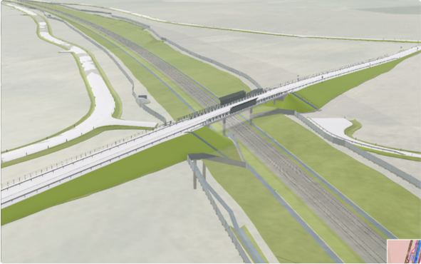
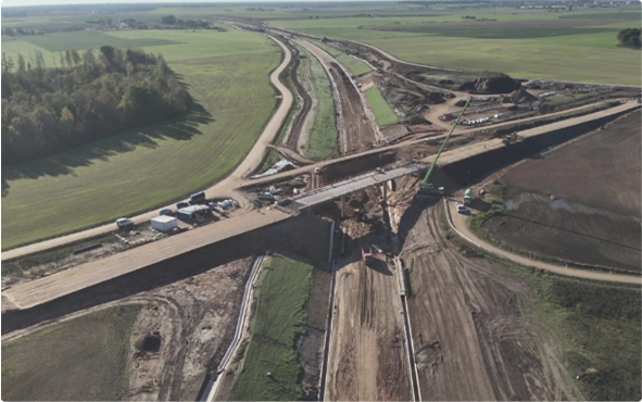
Rail Baltica is one of Europe’s most complex infrastructure projects, spanning multiple countries with varying regulations, engineering standards, and stakeholders. To ensure seamless collaboration, the project relies on Building Information Modeling (BIM), which standardises data management across disciplines such as engineering, railway systems, and asset management. In large-scale projects like this, BIM helps reduce inconsistencies and significantly improves coordination.
Managing data across multiple countries requires joint governance and standardization. By creating a Common Data Environment (CDE), BIM ensures consistency in terminology, prevents miscommunication, and enables early clash detection, reducing costly rework in large-scale
projects.
Beyond construction, BIM continues to add value throughout the railway’s lifecycle. As the digital model evolves with the project, continuously
updated with as-built information and maintenance records. Maintenance teams can access precise data on materials and past interventions,
improving efficiency and prolonging infrastructure lifespan. Instead of fragmented paper-based documentation, asset managers rely on a digital
twin, enabling data-driven maintenance decisions.
While implementing BIM comes with challenges, its long-term benefits-improved efficiency, cost control, and better lifecycle management-make it
an essential investment in Rail Baltica’s success. By embracing digital innovation, the project is setting new standards for modern railway
construction and operation.
In addition to detailed design models, spatial data plays a crucial role in the project. High-precision mapping tools in Geographic Information System (GIS), including LiDAR scans and satellite imagery, provide a comprehensive view of the natural and built environment. This information supports land acquisition, environmental assessments, and construction planning, helping to align infrastructure with the geographical realities of the region.
GIS in the Rail Baltica project provides essential geospatial services, helping manage and organize location-based data across all project stages – planning, design, construction, and future maintenance. It streamlines data storage and access, ensuring all partners have accurate, up-to-date information on the railway’s physical design, construction details, and any modifications over time.
One of the key benefits of GIS is that it can be used not only by office teams, but also by workers on the construction site. Using mobile devices like smartphones or tablets, field workers can access real-time data, such as maps, project designs, or construction plans, right on the spot. This allows for better coordination, quicker decision-making, and more accurate execution of tasks on the ground.
By using GIS across both the office and the field, Rail Baltica ensures that the project is managed efficiently from start to finish, and that data is available for future use, whether it’s for repairs, upgrades, or ongoing improvements to the infrastructure.
Rail Baltica’s digital framework extends beyond construction into operations, with Asset Information Management (AIM) ensuring long-term efficiency and safety. Every asset – bridges, tunnels, tracks, and signaling systems – is documented, enabling predictive maintenance to minimise downtime. The AIM team maintains an Asset Register, integrated with GIS and OpenBIM data, for accurate tracking and management of infrastructure assets.
Effective maintenance starts with reliable information about physical assets.
For example:
- To maintain overpass stairs, we need to know their location and construction materials.
- To prevent culverts from clogging, we need real-time monitoring systems in place.
- To track flood risks, we can use satellite data and sensors to observe water levels in culverts and surrounding areas.
By combining AI and GIS, Rail Baltica can predict and prevent issues before they escalate into costly problems. For instance, AI can analyse weather conditions and identify culverts at risk of blockage, allowing teams to focus inspections where they are needed most. This targeted approach reduces unnecessary costs and improves maintenance efficiency.
While many infrastructure companies build their asset registers using drone images, Rail Baltica has a unique advantage – it can develop its register from highly detailed digital models (IFC data and related information) right from the start. This ensures unprecedented accuracy and efficiency in asset management, setting a new standard for modern railway infrastructure.
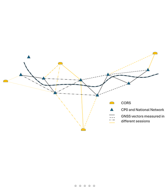
Geodesy is the science of measuring and mapping the Earth’s shape, gravity, and spatial orientation with precision. Rail Baltica relies on advanced geodetic tools – total stations, satellite systems, laser scanners, drones, and specialized surveying tools – to ensure accuracy in design, construction, and operation.
Accurate geodetic work is crucial for the success of the Rail Baltica high-speed railway – both during construction and later in its operation. Large-scale mapping and topographic plans provide the essential groundwork for railway design. Using geodetic measurements, engineers create detailed 3D models of landscapes and structures, ensuring precise planning, construction, and quality control.Given the complexity of railway construction, Rail Baltica has established strict technical requirements for geodetic work. These standards ensure that all stakeholders – including designers, contractors, authorities, and supervisors – work within a unified geodetic reference system.
This alignment is key to efficient planning, seamless coordination, and long-term maintenance. As the most ambitious infrastructure project in the Baltic region, Rail Baltica poses unique challenges for geodetic engineers. They are often required to develop and apply solutions that have never been used before, pushing the limits of precision and innovation in modern railway construction.
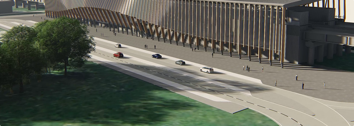
A model for future infrastructure
Rail Baltica is pioneering a data-driven approach to infrastructure, seamlessly integrating design, construction, and operations to ensure long-term efficiency, cost-effectiveness, and sustainability. Its digital twin supports smarter asset management, while an open-data approach guarantees long-term accessibility. By developing an evolving digital ecosystem, Rail Baltica sets a new benchmark for future large-scale projects – showcasing how data-driven decision-making can enhance project delivery, reduce costs, and improve connectivity across Europe.


